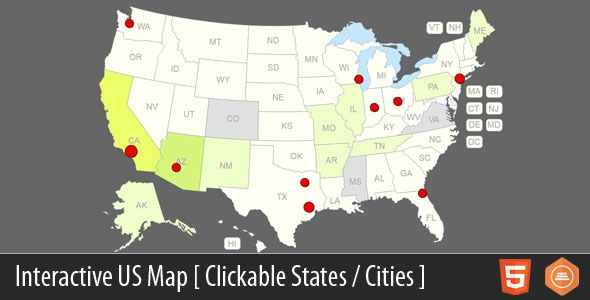
Interactive US Map Media is a CodeCanyon script that renders a clickable map of the United States, with all 50 states plus the District of Columbia acting as separate links and an unlimited number of custom pins that can be placed anywhere on the map. It ships in two forms — a WordPress plugin and a standalone JavaScript template — so the same map can be dropped into a WordPress site or a hand-coded HTML page. It suits site owners, freelancers and agencies that need a visual US navigation layer, such as a store locator, a state-by-state directory or a regional landing page hub, without building the map geometry and interaction logic from scratch.
What the script actually does
The core of the product is a vector map of the United States built in HTML5. Each state, plus DC, is an individually addressable shape rather than a single flat image, which means every region can carry its own link, hover state and tooltip. That is the difference between a decorative map graphic and one that functions as a navigation menu.
On top of the state layer sits a pin system. The vendor states the number of clickable pins is unlimited, so a project can mark cities, offices, dealers, event venues or pickup points and give each one its own destination URL. Pins are independent of the state shapes, so a single state can hold many pins or none at all.
Two delivery formats for two kinds of project
The package includes a WordPress plugin and a JavaScript template. The WordPress version is the practical choice when a client wants to manage the map from the admin area and edit links without touching code. The JavaScript version suits developers who want to place the map inside an existing front end, a static site, a custom CMS or a page builder that accepts raw HTML, CSS and JavaScript. Source files are supplied as JavaScript, HTML and CSS, so the markup and styling can be edited directly.
Resolution and browser support
The vendor lists the map as high-resolution, which matters because vector output stays sharp on retina and 4K displays where a bitmap map would blur. Declared browser support covers Chrome, Firefox, Safari, Opera and Internet Explorer 9, 10 and 11. That last point is a signal about the age of the underlying codebase — IE11 support is a legacy requirement that most modern WordPress themes and page builders have long since dropped. It is useful if a client still runs an old intranet on IE, and irrelevant otherwise.
Linking behaviour
Each state and each pin can point to any URL. In practice that means a map can act as a router: click Texas and land on a Texas category archive, click a pin in Austin and land on a single store page. The vendor does not state whether links can be set to open in a new tab, whether custom tooltips accept HTML, or whether click events can trigger JavaScript callbacks instead of navigation. Those details would need to be confirmed in the live preview or by contacting the author before committing to a build that depends on them.
Where this fits, and where it does not
The strongest fit is a site whose content or services are organised geographically. A franchise with locations in a dozen states, a trade association with member chapters, a tourism site with regional guides, a logistics company listing depots, or a real estate portal browsing by state — all of these benefit from a map that doubles as a menu. The visual layer shortens the path to geographically filtered content and gives a page a focal point that a plain list of state names cannot match.
Freelancers and small agencies will get the most value, because the alternative is either licensing a heavier mapping library and building the interaction layer, or paying a developer for several days of custom work. At $27, the script is cheaper than an hour of most developers’ time, and the WordPress plugin route means a client can be handed a finished site with an editable map.
It is the wrong choice when the map needs to do more than link out. If a project requires real geolocation, driving directions, live data overlays, address search with autocomplete, or a genuine GIS layer with county and zip boundaries, this is a presentation tool, not a mapping platform. It is also a poor fit for sites outside the United States — the vendor offers a separate world map, but this product is US-only — and for anyone who needs up-to-date cartographic accuracy, since simplified state outlines are usually drawn for legibility rather than survey precision.
Strengths and limitations
Strengths
- Fifty states plus DC are individually clickable, so the map works as navigation rather than decoration.
- Unlimited pins give the same map a second layer for cities, branches or points of interest.
- Two formats in one purchase — a WordPress plugin and a plain JavaScript template — covers both client-managed and developer-managed builds.
- Source files are included, so colours, fonts, hover states and tooltips can be restyled to match any brand.
- High-resolution vector output stays crisp on modern displays.
- Established track record: 2,138 sales and a 4.77 out of 5 rating from 95 reviews, which is a meaningful sample for a CodeCanyon item.
- Last updated in February 2025, so the item is not abandoned.
Limitations
- Declared IE9–IE11 support points to an older JavaScript approach. That is fine for legacy environments but may feel dated next to modern component-based tooling.
- There is no stated option for county, zip code or congressional district boundaries. Projects needing sub-state granularity must look elsewhere.
- Pin placement appears to be manual — the vendor does not describe latitude/longitude input or bulk import, so a map with hundreds of pins would be laborious to populate.
- No documented JavaScript API, callback hooks or event system, so integrating the map with custom filtering logic is not guaranteed to be straightforward.
- Accessibility is not addressed in the listing. Keyboard navigation and screen-reader labelling for clickable map regions are common weak points in this category and would need to be tested.
- US-only. International projects need a different product.
How it compares with the alternatives
There are three broad routes to a clickable US map. The first is a general-purpose mapping library, which offers real geographic data, geocoding and routing, but requires API keys, ongoing quotas and significantly more development time. The second is a page-builder map widget, which is quick to insert but usually renders a single image with image-map hotspots — no pins, no styling control, and often no WordPress-native editing.
This product sits between those two. It offers more structure than an image map and far less machinery than a full mapping platform. The trade-off is deliberate: the map is a lightweight, self-contained front-end component that links out, not a data-driven application. For the majority of geographic navigation use cases, that is the right level of complexity, and it keeps page weight and setup cost low.
The other differentiator is the dual format. Most items in this category are either a WordPress plugin or a JavaScript template, not both. Buying one licence and getting both means the same asset can be reused across a WordPress client site and a static build without a second purchase, which is a real advantage for agencies working across mixed stacks.
Frequently Asked Questions
Do I need to know how to code to use Interactive US Map Media?
No, if the WordPress plugin route is used. The map can be inserted and its links managed from the WordPress admin area. The JavaScript template, by contrast, assumes comfort with HTML, CSS and JavaScript, since the map has to be placed into an existing page and its configuration edited in the source files.
Can the map show cities as well as states?
Yes. States are clickable by default, and the vendor states an unlimited number of clickable pins can be added anywhere on the map, which is how cities, branches or venues are represented. Each pin links to its own URL, so city-level navigation is possible alongside the state layer.
Is the map mobile responsive?
The vendor does not explicitly state responsive behaviour in the listing. Because the map is built with HTML5 and CSS and supplied as high-resolution vector output, it can generally be scaled with stylesheet rules, but anyone needing guaranteed touch-friendly behaviour on phones should test the live preview before buying.
Does it work with the latest WordPress and PHP versions?
The vendor lists HTML5, JavaScript, HTML and CSS as the compatible software and does not publish a minimum PHP or WordPress version. The February 2025 update suggests active maintenance, but compatibility with a specific WordPress and PHP combination should be confirmed with the author before purchase.
Verdict
Interactive US Map Media is a sensible buy for site owners, freelancers and agencies that need a clickable US map as a navigation and linking layer, particularly where the same asset has to serve both a WordPress site and a hand-coded build. The combination of 50 clickable states, unlimited pins, editable source files and a 4.77 rating across 95 reviews makes it a low-risk purchase at $27. It is not the right product for projects that need geocoding, routing, sub-state boundaries or live data overlays, and anyone building for a modern accessibility standard should verify keyboard and screen-reader behaviour first. Buy it for geographic navigation; look at a full mapping platform for geographic functionality.